
Lost Wee Weirs of the Forth
Project Overview
The Forth’s rivers reflect its varied history as landowners and entrepreneurs have shaped our land and rivers to meet the needs of agricultural improvement, drive industrial progress, transport our basic goods and glorify modern-engineering in the creation of designed landscapes. This has left countless legacies in the social and economic context of Scotland, but a significant environmental one is the hundreds of barriers in our rivers, inclusive of sluices, dams, weirs, and culverts. These barriers have interrupted the natural processes of our rivers (e.g. moving sediment across the landscape) and ceased the unimpeded movement of our iconic, native fish species.
The Lost Wee Weirs of the Forth Project 2022-2023 examines and tests the potential for complete removal of 3 very different weirs across 3 rivers in the Forth. Providing the basis for skilling up our team, learning through doing and making our rivers easier for our wildlife.
This project focuses on three small weirs, that would be potentially removable by the use of small scale construction works i.e. not needing to use a digger. For each weir it was hoped that we could progress to licence to remove these, each started with located the weir owner and scoping the potential to remove.
This is an update as of March 2023 on the progress with the porject:
Old weir on the Linnhouse Water (part of the Almond, West Lothian)
This is now known as Morton Quarry Weir, although its origins are still very much unknown. Connected to the construction of the inter-city rail line viaduct, part of the Oakbank oil shale and chemical works, or the quarry that is now local fish ponds. The partial removal licence has been submitted to SEPA and is due to be reviewed and issued by early May 2023. In the meantime, we are still seeking the owner of their weir.
A stepped weir on the Dollar Burn, (part of the Devon, Clackmannanshire)
A series of steps made of old rail tracks and concrete, which was renovated by a past local living landscapes partnerships. Unfortunately, this project was deemed high risk due to its urban nature and high sedimentation in the catchment, which we will be studying in more detail in the coming months. As a result the potential capacity to remove this structure would have cost a great deal and made the project economically unviable.
A derelict laid-stone weir (part of the Black Devon, Clackmannanshire)
This small weir is part of an old coal rail bridge that ran across the river here. Now removed the base of the weir remains. Sadly, the weir owner in this instance now wishes to explore the potential for hydro at the site, so is not able to support a voluntary removal application.
In total these weirs, if they were removed, will open a total of ~16km of downstream habits and ~25km of upstream river, plus access to a number of tributaries containing spawning ground and rediscover-able habitat.
The weirs included within this first application to the Open Rivers Fund, were been chosen since they are not and will never be the focus of barrier removal through the current barrier removal at the national level. Yet, still pose a significant issue to fish migration, natural sediment transferal and other hydromorphological processes. These types of smaller river barriers are more numerous than the larger obstacles in our catchment and are often over-looked. The accumulative impact of these smaller barrier cannot be understated.

Forth Catchment River Accessibility Map
Objectives
- Scope the potential for removal of 3 very different barriers.
- Upskill the team and partners for future opportunities.
- Improve migratory fish passage.
- Reduce the loss of biodiversity from impounds.
- Increase the different habitat and flow types within the channel.
- Restore river processes e.g. sediment transport.
Funder

The Open Rivers Programme will help restore European rivers by funding and supporting dam removal projects throughout the continent. Thanks to a €42.5 million investment over six years by the charitable fund Arcadia, the Programme will scale up dam removal and help Europe’s endangered rivers run free once again!
Rivers
Linhouse Water – A part of the Almond catchment, this is often said to be the best tributary with regards to water quality though the flow is controlled by the artificial reservoir at Crosswoods. It comprises of several upland burns such as the Camilty Water, Black Burn, Whitelea Burn, and the Morton Burn. This section of the Almond also features the picturesque Linn Jaw waterfall, which limits migratory fish access above this point. Below this sits an idyllic bedrock river, with rock shelves and uplift, one of which has the old Morton Quarry weir constructed. Though most of the structure has collapsed, what remains limits strong fish making their way up stream. The Linhouse flows through Linhouse glen before meeting the main stem of the Almond at Mid Calder.
Black Devon – This is a mix of bedrock and gravel river which has been heavily influenced by the exploitation of the rich coal seams in the Clackmannanshire area, as a result much infrastructure such as rail lines has been added to the river.
Devon – Starting in the dramatic Ochils much of the rivers flow has been altered by the creation of several reservoirs, it flows through the Glendevon area before joining the Forth at the village of Cambus.
Contact
Contact the staff about these barriers or other potential barrier or weir removal projects by emailing us via the ‘Contact Us’ page.
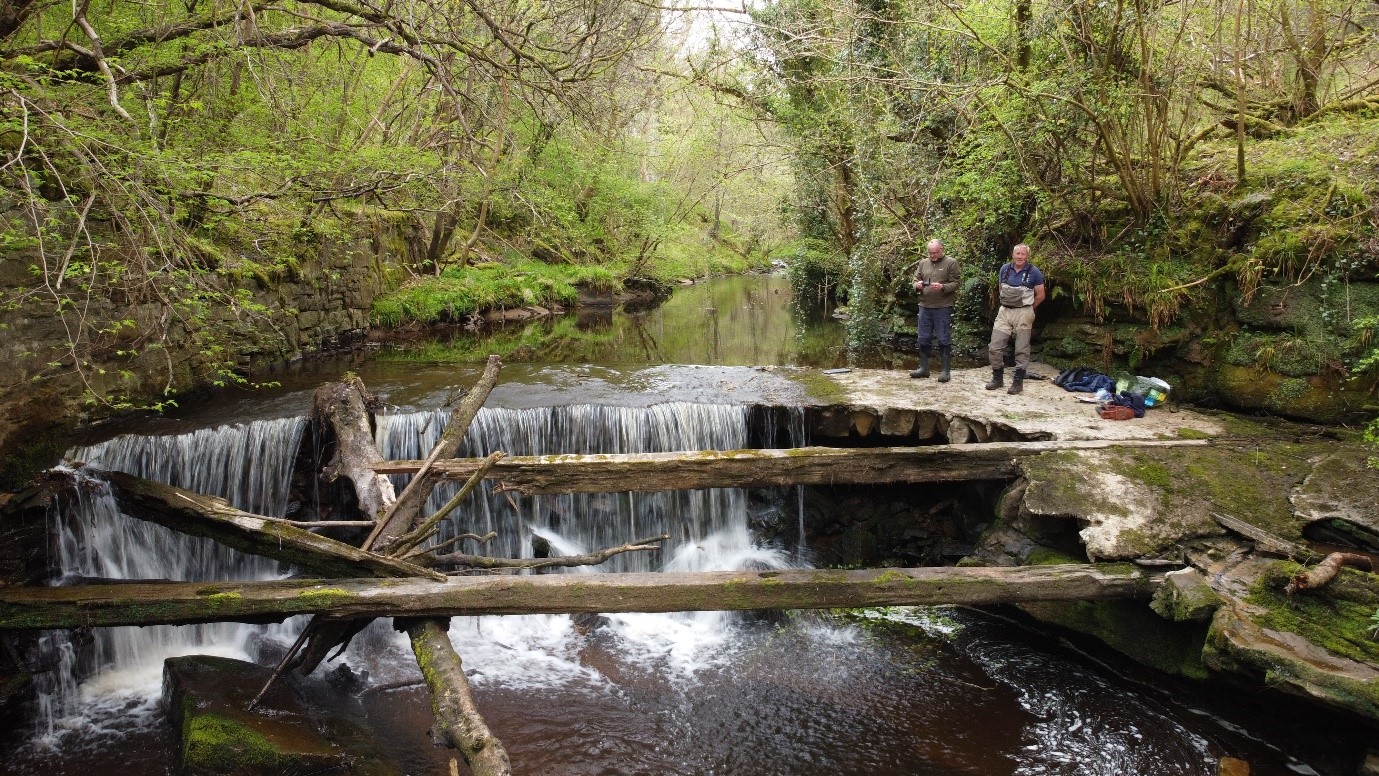
Morton Quarry Weir, Linhouse Water

Dollar Steps, Dollar Burn
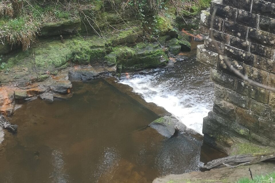
Linn Mill, Black Devon